


Route Maps
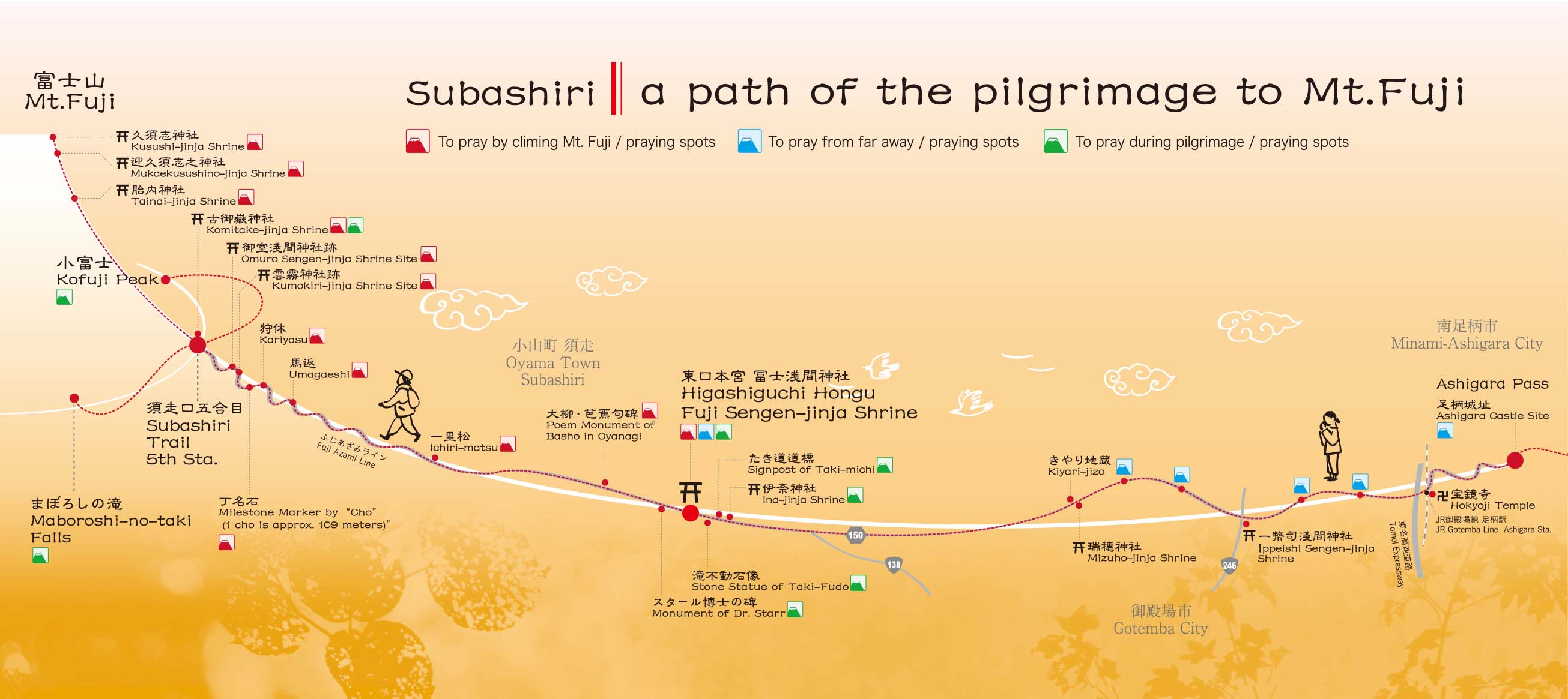
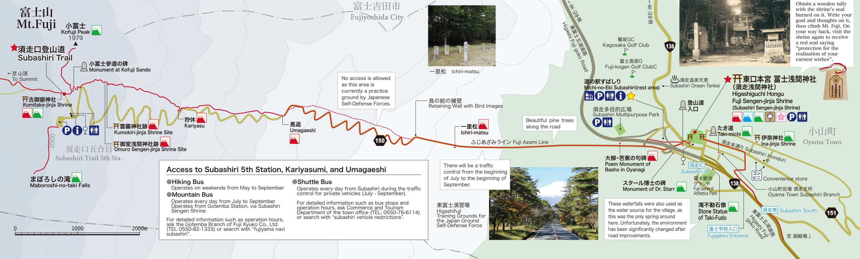
The Ashigara Mountain Pass leads to Takenoshita, where a big fight dividing the country into two happened in the 12th century.When you enter the Prefectural Road No.150, Mt. Fuji is seen in front with a panoramic rural background. This route connecting Kanagawa, Shizuoka, and Yamanashi prefectures were also called [Kamakura Oukan]. When you enter the Subashiri area, the forest belonging to the Fuji Sengen Shrine and Mt. Fuji are seen from the Subashiri Hondori Street.
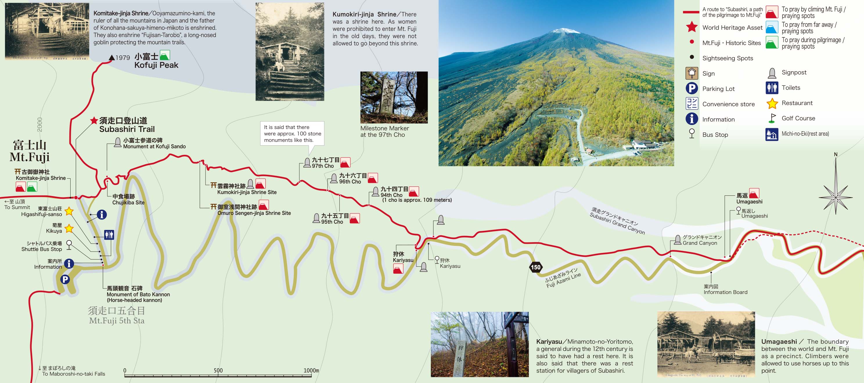
After refreshing your thoughts by praying at the shrine, go to the point called [Umagaeshi] enjoying a view of Mt. Fuji and beautiful pine trees along the street. People of ancient times got off their horses here, as beyond this point is no more earthly life, belonging to the gods.
Then go to Kofuji where exist the waterfalls that can be rarely seen.
A typical view of Mt. Fuji, covered with gravel, is seen from this point, with a panoramic view including Lake Yamanaka and Suruga Bay.
The sunrise that can be seen between the sea of clouds from this point is really splendid.
This route, leading to Subashiri 5th Station, is open from the end of April to the beginning of November.
From Ashigara Pass to Mt. Fuji|Overall view
Click to magnify
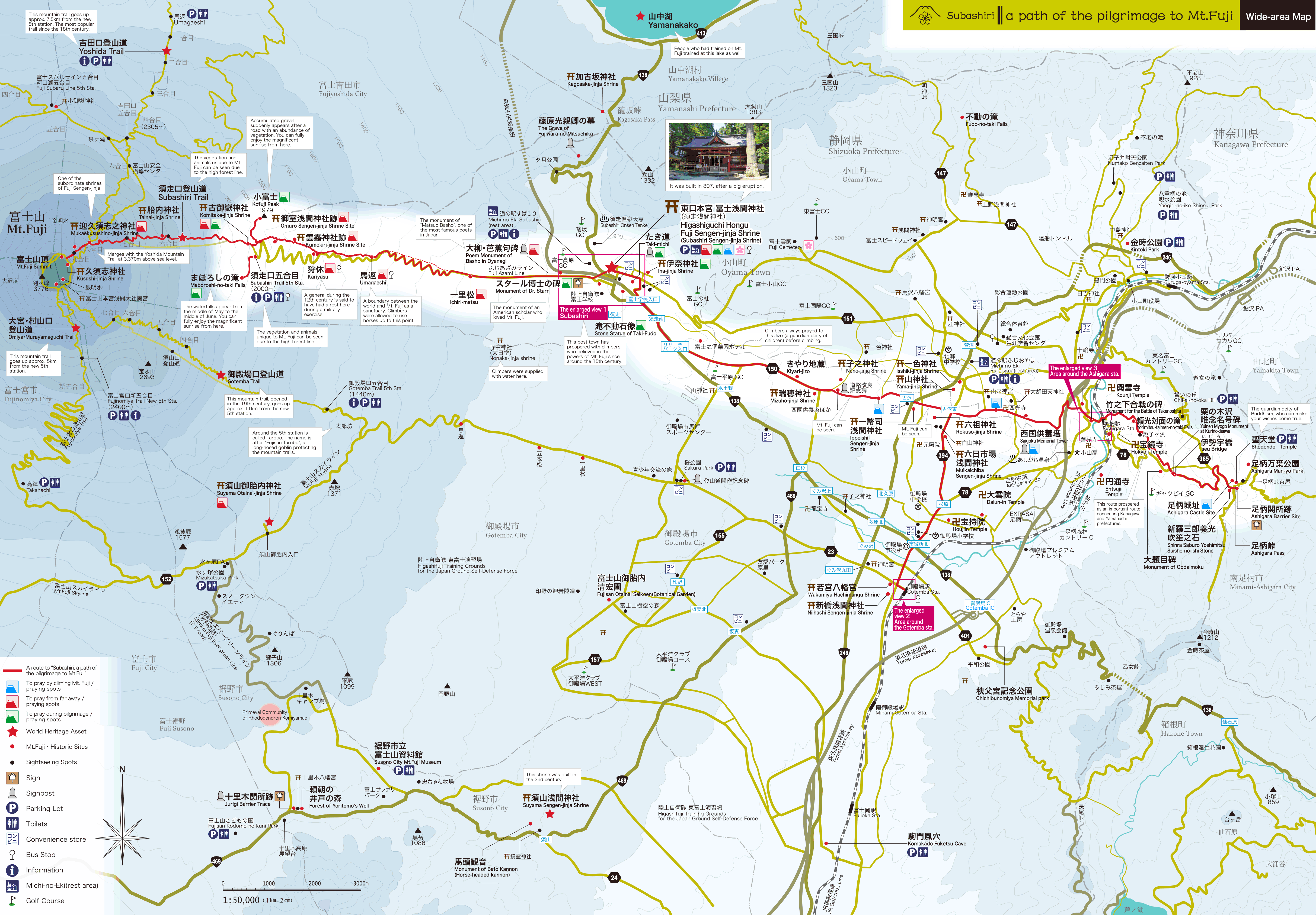
Wide-area Map
Click to magnify
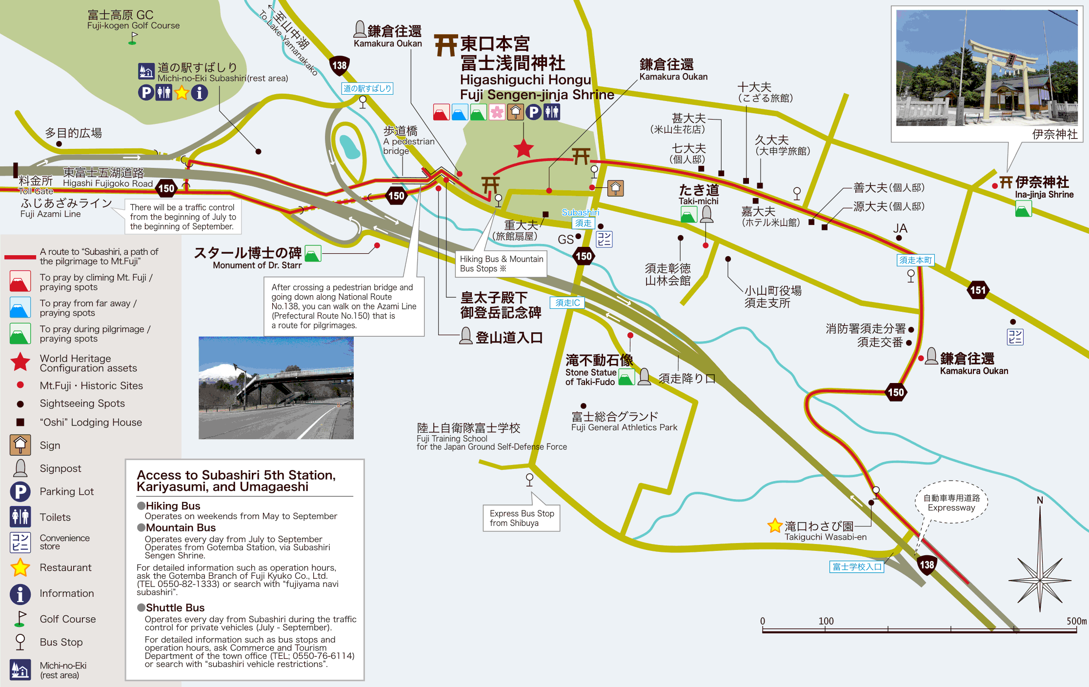
Subashiri
Click to magnify
Area around the Gotenba Station
Click to magnify
Area around the Ashigara Station
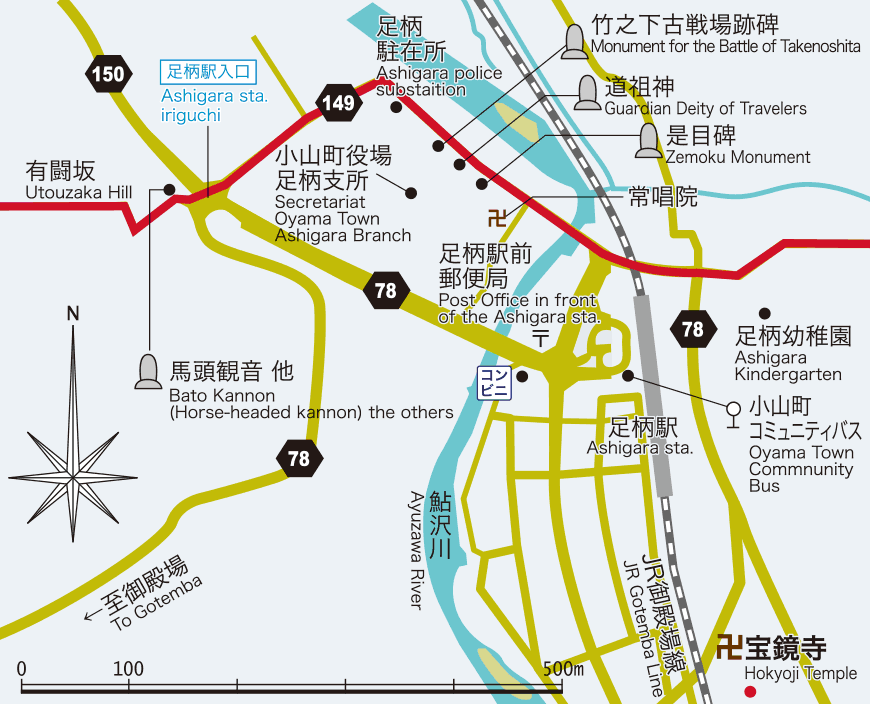
Click to magnify
Subashiri Sengen-jinja Shrine to Kofuji
Click to magnify
From Umagaeshi to Kofuji
Click to magnify